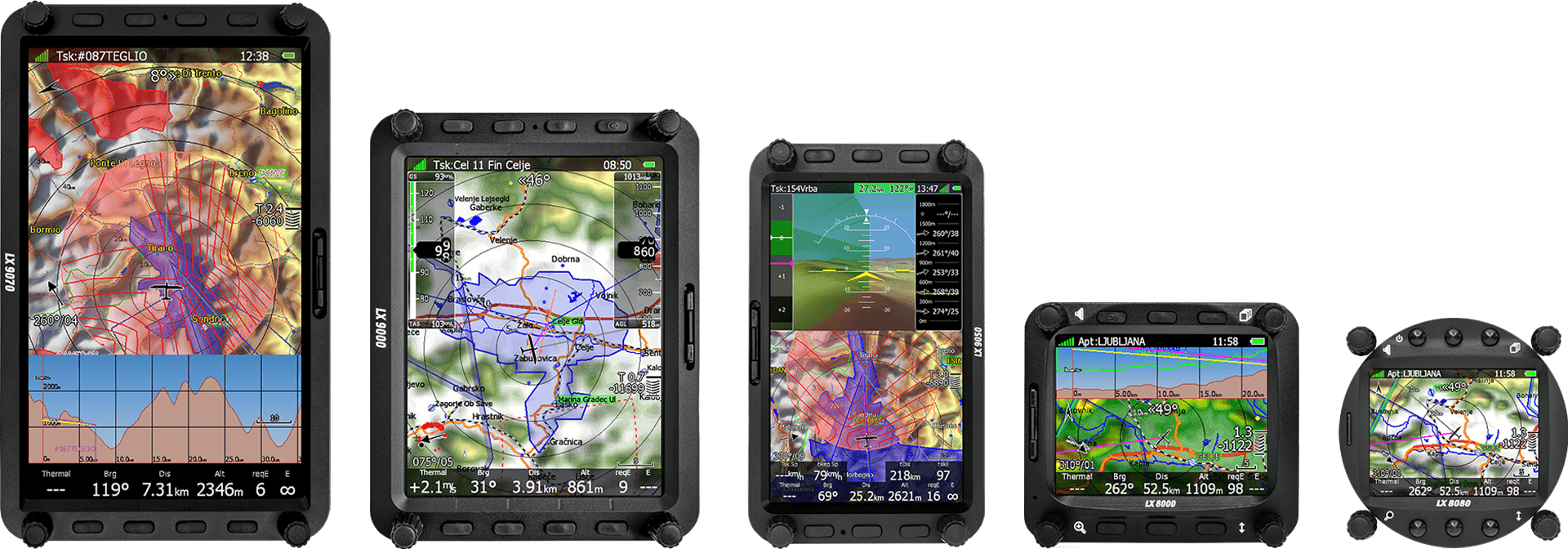
The Pilot’s Choice
LX 9000 device comes packed with a V8 variometer (optionally with V9 or V80). The LX 9000 system is the world’s most advanced computer for any kind of glider.
5.6”
Anti-glare Display
0
LX9000 devices in use

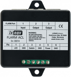
PowerFlarm Integrated
FLIGHT RECORDER. Integrated.
High-level IGC approved flight recorder with advanced engine noise level sensor. With MOP and MOP2 devices also JET, Electro and FES approved.
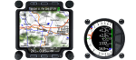
Portrait or Landscape.
Simple conversion from a Portrait to Landscape orientation.
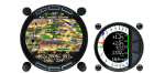
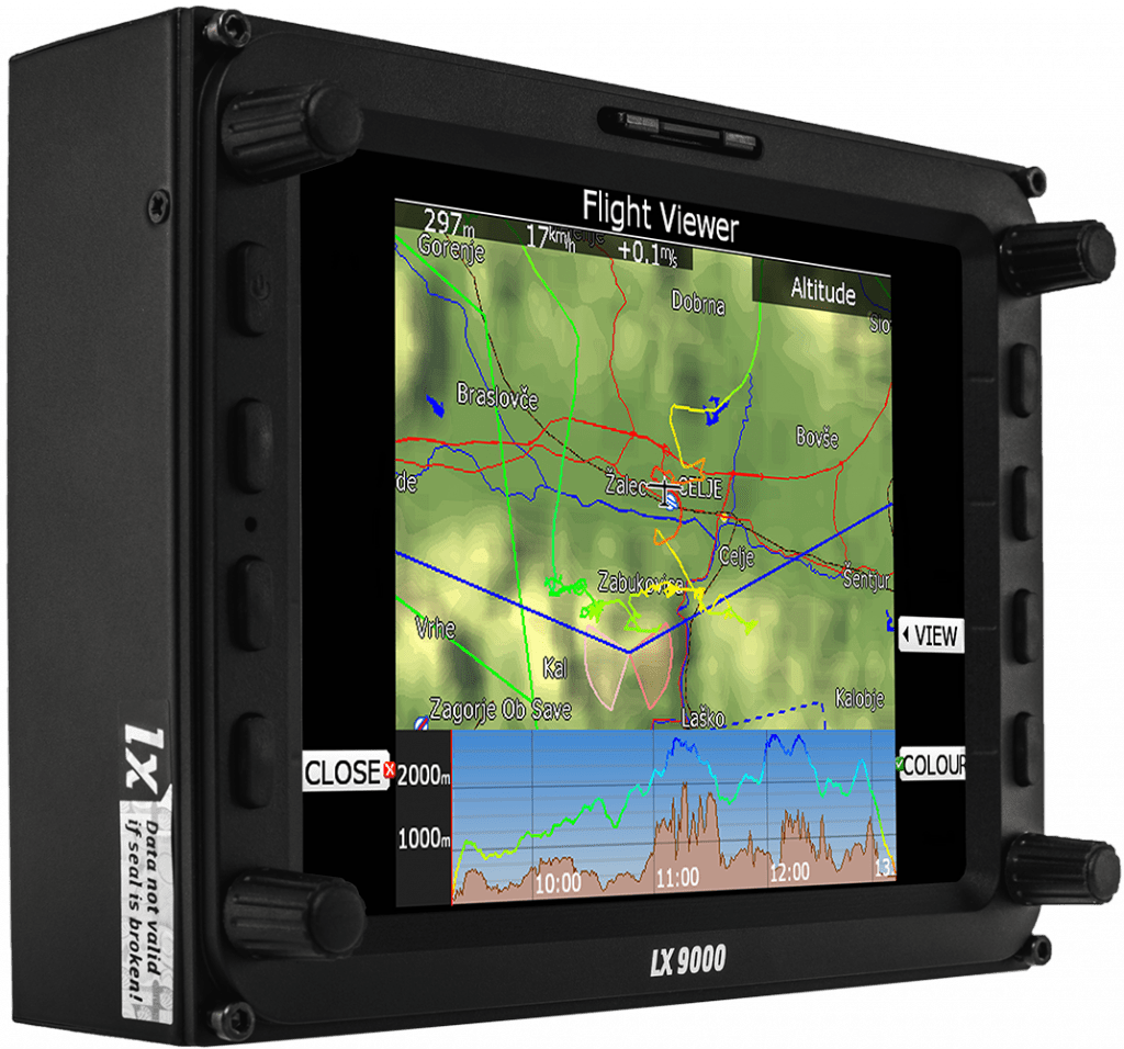
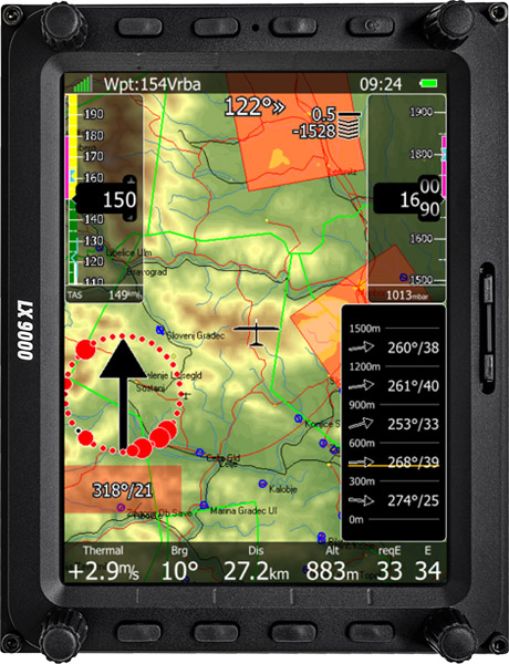
The Map. Details. Whole world.
Preloaded worldwide terrain, map, airspace and airport databases – FREE of charge!
ICAO. IFOS. Rogersdata.
Buy and load your own ICAO maps.
TOUCH SCREEN.
The long-awaited touch screen is here (the fifth generation). The most advanced and responsive navigation touch screen.
I have touch screen option and haven’t had any problem. The screen works well, and the visibility is good.
As it was said, touch screen is a big advantage, both on the ground or even in flight.
Ludovic Launer, pilot
LX Philosophy.
We’ve kept the same logic, that has already been well-proven on LX4/5/70xx devices.
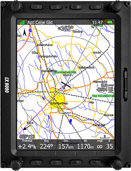
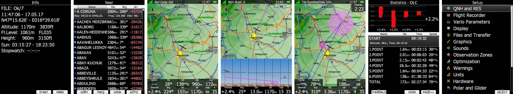
APT mode. RWY info.
Airport mode navigates to a selected airport with all necessary information, such as RWY direction, length, frequency and type (grass/asphalt). Each page layout can be completely customized by LX Styler.
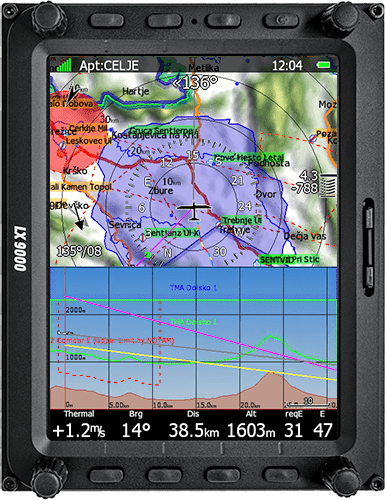
Waypoint and Task Mode.
Very simple selection of Waypoints with an intuitive user interface. Create a task on the device or in SeeYou and simply load it via the SD, USB or Wi-Fi.
Assigned Area Task AAT.
The AAT assistant shows the most optimized direction for maximum speed on the task. A very accurate time calculation helps you to arrive home precisely on time.
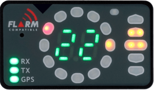
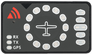
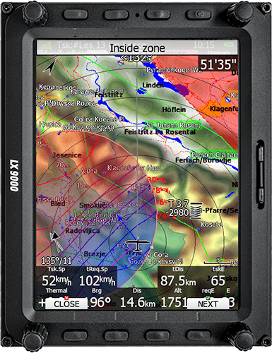
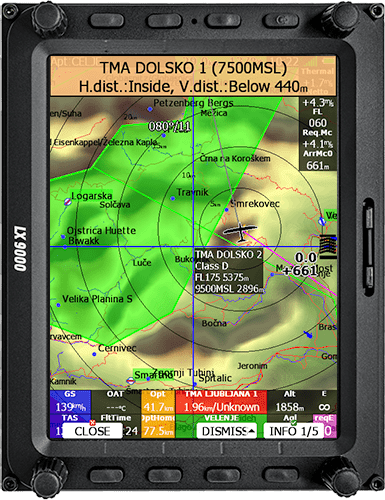
FLARM mode.
This feature displays all types of FLARM objects. ADS-B and PCAS objects can also be displayed if compatible, external devices are connected.
FLARM Visual Radar With Audible Warnings.
The Radar shows all necessary data. The target’s present position, altitude and vertical speed are displayed on the map. For each new alert a pop-up appears automatically when a potential collision occurs. The system will also trigger a sound and/or voice warning.
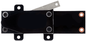
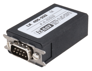
Internal/External.
Flarm/PowerFlarm can be either an internal or an external module.
ADS-B In.
Optionally can be built in.
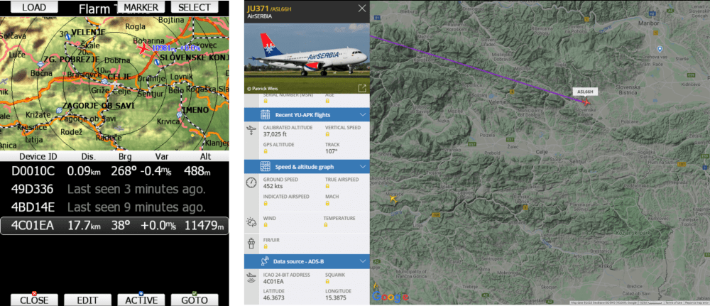
Live traffic data via ADS-B on your LX9000
Wi-Fi connectivity. SD card. GPS module. USB.
Wi-Fi module, SD card socket, 56 channel GPS module built in and USB port for data.
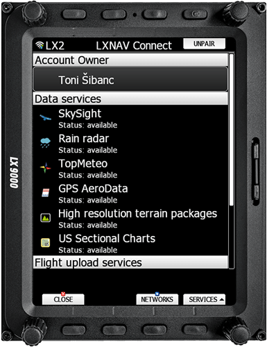
Be online anytime, anywhere.
With LXNAV Connect and Wi-fi module, unlock the full potential of your device.
Many different services with even more on the way.
NOTAMs, flight uploads, GPSAeroData, US Charts, device upgrades and many other features are now just a click away even while flying.
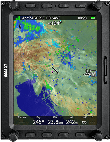
Rain radar.
Don’t be worried while flying a long distance flight – now you can see a real time rain radar picture while in the air.
Satellite image.
Combine it with satellite image to ensures you stay one step ahead of the weather at all time.
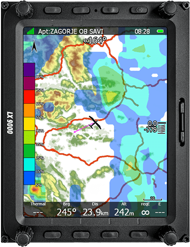
TopMeteo and SkySight weather forecasts.
Its like having a meteorologist flying by your side with weather forecast services provided by TopMeteo and SkySight. More then 20 different weather layers allow you to plan your flight to perfection.
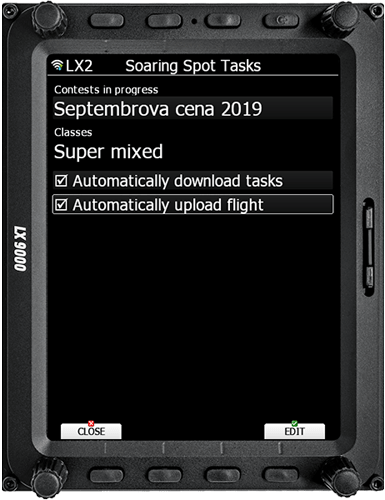
Soaring spot. E-mail.
Download competition task on race-day from Soaring spot and send your day-winning flight log by email to competition director with just one push of the button.
OLC.
Uploading your flight to OLC has never been easier.
File sharing.
Google drive and Dropbox support makes synchronizing waypoints, tasks, airspaces and pilot profiles fast and simple. It makes carrying SD-card around a thing of the past.
ENL!
Advanced Engine Noise Level Sensor
PAN Mode. GO-TO.
GO-TO function without any waypoints by using the PAN mode. Simple and visual exploration of nearby airspaces with all details.
Optimized Terrain Schemes.
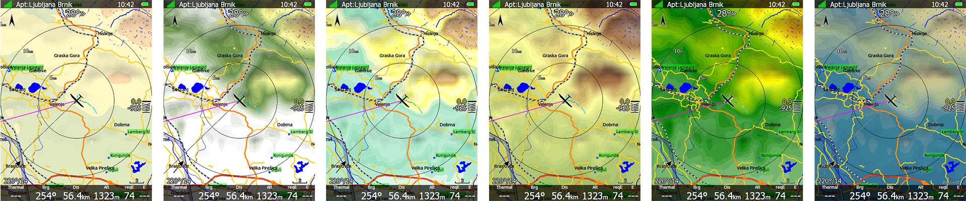
14 Terrain presets available.
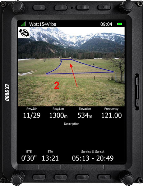
CUPx files: Landable Fields With Pictures.
Create your own Waypoint file with terrain photos.
Wind.
An inertial variometer provides a very accurate wind indication during straight flight.
4 different methods are used to precisely calculate wind speed and direction.
Wind Side Profile. Wind Arrow.
The wind altitude profile displays the wind indication at different altitudes. The wind arrow shows the current wind direction. The arrow can be customized in size, position and colour.
HAWK wind calculation
Real time wind
The HAWK platform applies an “extended Kalman filter” (EKF) algorithm which jointly estimates all three dimensions of the air mass movement – INSTANTANEOUSLY
No compensation, no problem
No compensation needed, since it uses no law of energy conservation. More accurate netto vario readings independent of glider speed.
V9 / V8 / V80 variometers
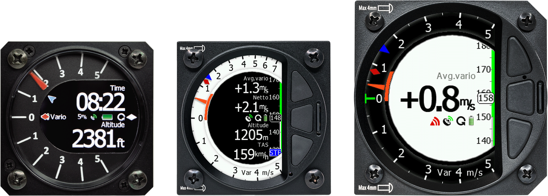
This next generation line of inertial variometers is unequalled in the market.
Generations
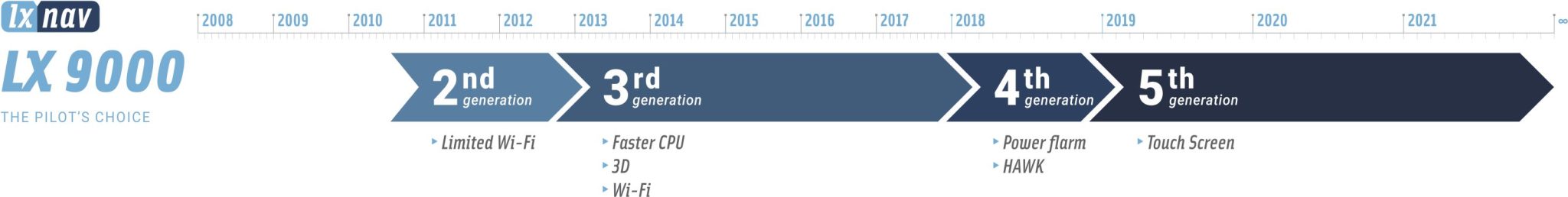
On the 2nd Generation the last supported Software is Version 8
Configurations
| LX9000 T | LX9000 | |
|---|---|---|
| Touch Screen | - | |
| V8 vario | ||
| V9 vario | Optional | Optional |
| V80 vario | Optional | Optional |
| IGC approved flight recorder | ||
| Built-in GPS | ||
| Voice messages | ||
| Profile customization with LX Styler/Style function | ||
| Support for waypoints file with images | ||
| Terrain | ||
| Map elements (roads, highways, water bodies, railways, town names) | ||
| PowerFlarm | Optional* | Optional* |
| 2nd flarm antenna | Optional* | Optional* |
| AHRS | Optional* | Optional* |
| ADS-B In | Optional* | Optional* |
Second Seat Device